At Silkstone, we pride ourselves in offering a wide range of professional surveying services tailored to meet the diverse needs of our clients.
Comprehensive Surveying Services
Leveraging cutting-edge technology and a team of experienced professionals, we provide accurate and efficient data for construction, planning, and design projects.
Whether you're working on a building renovation, site development, or quarry management, our surveys deliver reliable insights to support your success.

Explore our specialised services:
Measured Building Surveys
Our Measured Building Surveys are designed to provide precise data on building structures and the existing built environment. With years of expertise and the latest technology, including laser scanners and drones, we ensure that all measurements are accurate and comprehensive.
We tie and project all data onto the latest Ordnance Survey transformation model via GNSS. Alternatively, pre-existing or arbitrary systems can be utilised upon request. With the support of our highly skilled CAD team, we deliver detailed outputs, including:
- Floor plans
- External and internal elevations
- Cross sections
- Sectional elevations
- Roof plans
- Reflected ceiling plans
- Unrolled elevations
Our Measured Building Surveys empower architects, engineers, and developers with the information they need to execute projects confidently.
Topographical Surveys
Our Topographical Surveys offer an in-depth view of your site's natural and man-made features. Utilising Total Stations (TPS), GNSS, UAVs, and laser scanning, we can capture all site details in 3D, including:
- Development sites
- Brownfield and greenfield areas
- Roads and gardens
- Rivers and other natural features
From small-scale urban sites to large, complex landscapes, we have the expertise to deliver surveys tailored to your project's unique requirements. All data is tied to the latest Ordnance Survey transformation model or existing site grids upon request.

Reality Capture 3D Surveying
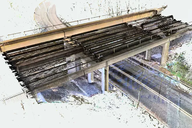
Our Reality Capture 3D Surveying services use advanced technologies to provide high-accuracy, visually detailed data for various applications. With a precision of up to 5mm, we ensure that every aspect of your project is accurately captured. Key features include:
- High-quality data with optional high-definition, full-color imaging
- 3D point cloud data compatible with AutoCAD, Revit, and other design programs
- 2D drawings with exceptional precision using AutoCAD
Reality Capture allows for the seamless integration of 3D models and precise measurements into your planning and design workflows, making it an ideal choice for complex projects.

Quarry and Landfill 3D Design Surveys
Silkstone provides fast and accurate Quarry and Landfill 3D Design Surveys for even the most challenging sites. With a specialist team and UAV technology, we survey inaccessible areas to produce accurate ground data and 3D models, aiding in practical design and planning.
Our dedicated in-house design team offers the following:
- 3D terrain modeling
- Ground profiles
- Volumetric calculations
- Stockpile volumetric surveys
- ZTV and ZVI line-of-sight drawings
Whether for stockpile management or design development, our surveys are tailored to meet the specific needs of quarry and landfill operations.


